Spotter Global Expands Drone Detection to 5 Kilometers With RDID 3.0
Spotter Global (Orem, UT) unveiled RDID 3.0 at GSX 2026, expanding Remote ID detection to more than five kilometers while integrating pilot tracking, cameras, radar and command-and-control.
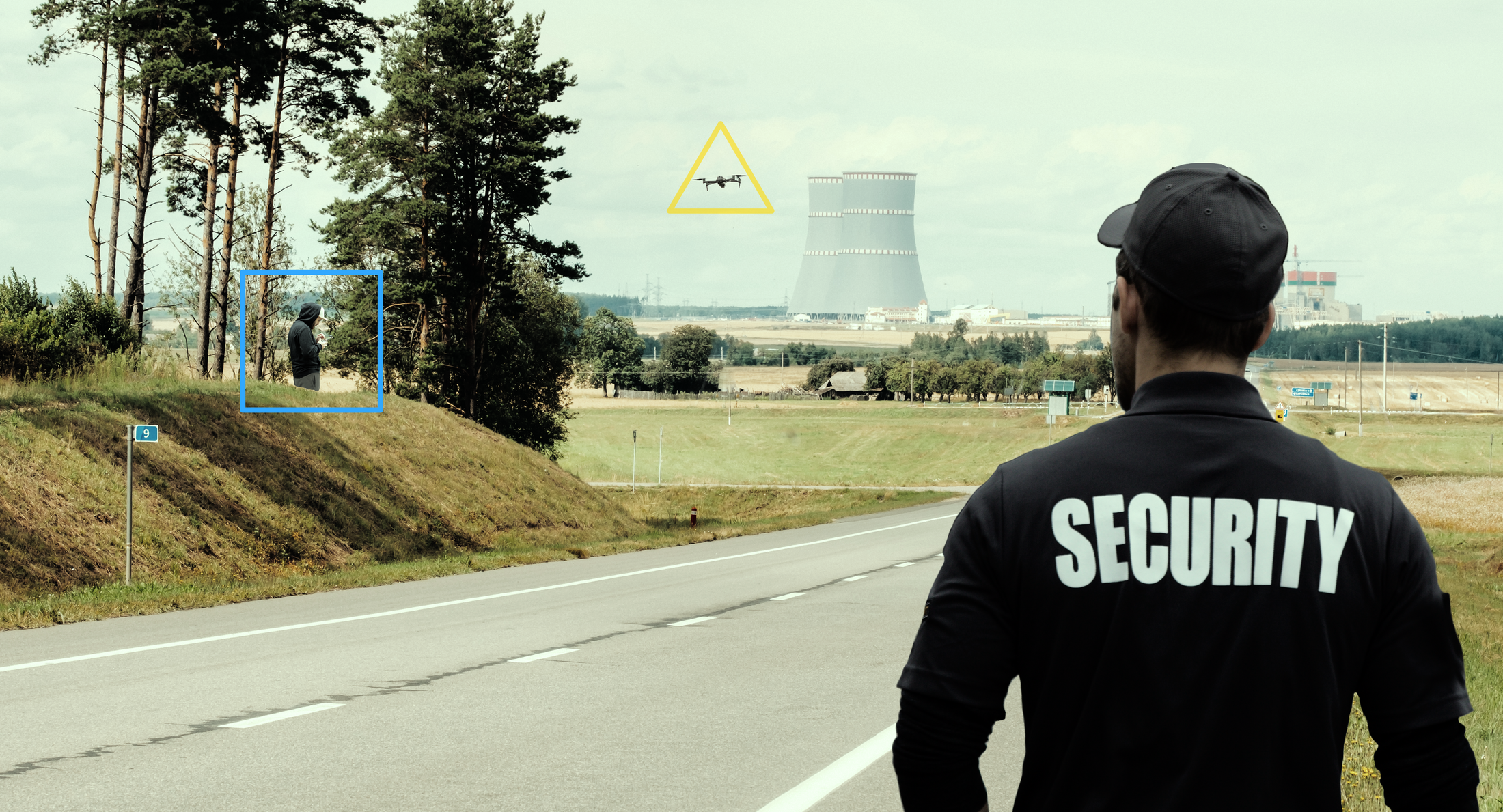
Detecting a drone is only part of the problem when an unauthorized aircraft enters a protected area. Security personnel also need to know what the aircraft is, where it is going and, when possible, who is operating it.
Spotter Global's latest system is designed to provide that additional layer of information.
The Orem-based company unveiled RDID 3.0 at the Global Security Exchange (GSX) in Atlanta this week, expanding the detection radius of its Remote Drone ID system from about 3 kilometers to more than 5 kilometers while adding faster tracking and integrated command-and-control capabilities.
The new system represents another step in Spotter's effort to combine multiple forms of perimeter-security data into a single operating picture — an approach the company is also pursuing with its GAX500-3D radar and NetworkedIO command-and-control software.
Spotter's RDID 3.0
From detecting the drone to finding the operator
Remote ID works somewhat differently from radar.
Rather than detecting an unidentified object based on its physical characteristics, Remote ID receives identification information broadcast by participating unmanned aircraft systems. RDID 3.0 uses those transmissions to track the aircraft and, critically, determine the location of its operator.
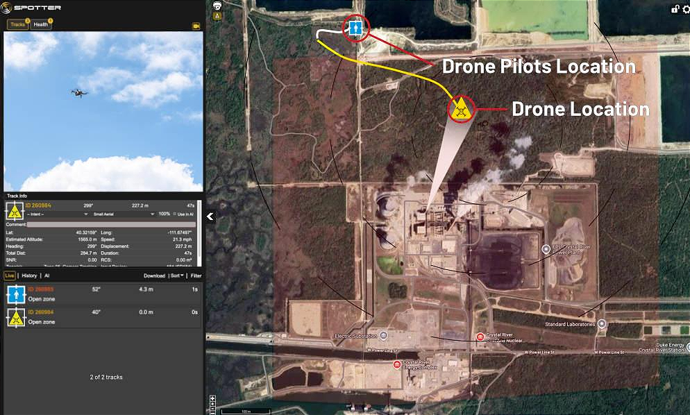
Spotter says the system can capture a drone's registration information while plotting the location of the person controlling it.
That distinction can matter for law enforcement, emergency responders and security personnel who may be able to locate and address a drone operator but do not have authority to employ electronic or kinetic countermeasures against the aircraft.
The company describes RDID 3.0 as being aimed primarily at lower-tier drone threats, including unauthorized or careless operators.
The new system extends Remote ID detection to a radius of more than 5 kilometers, compared with approximately 3 kilometers for the previous generation. That represents a substantial increase in potential coverage: a 5-kilometer-radius circle encompasses nearly 79 square kilometers, compared with about 28 square kilometers at a 3-kilometer radius, assuming unobstructed coverage.
Spotter says the system provides a full detection diameter of roughly 10 kilometers.
Putting the pilot on the map
The longer range is only one part of the RDID 3.0 upgrade.
Spotter has added what it calls Instant Pilot Routing, which automatically generates a map showing the route to the drone operator's location. The goal is to shorten the time between identifying an unauthorized drone and getting security personnel to the person operating it.
The system also increases its track-update rate to more than one broadcast per second, allowing the locations of both the aircraft and operator to be updated more frequently as they move.
But the larger change may be what happens to that information after it is collected.
With RDID 3.0, Spotter has embedded its NetworkedIO (NIO) command-and-control software directly into the sensor. That eliminates the need for separate C2 hardware for the system and allows Remote ID information to become part of the same security picture as other sensors and security systems.
That builds on the architecture Spotter introduced with the GAX500-3D earlier this year.
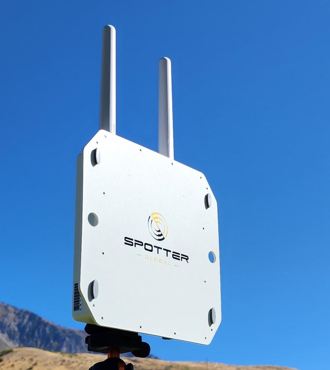
Spotter Global’s Remote Drone ID (RDID) sensor detects and tracks FAA-mandated Remote ID signals, providing the GPS location of drones and their pilots, along with the drone’s serial number, day or night.
The GAX500-3D uses the company's Compact Holographic 3D, or CH3D, radar technology to continuously monitor its field of view and update the positions of as many as 50 targets at 18 Hz. The radar is designed to provide precise three-dimensional tracks that can then be combined with video and other sensor data through NIO.
RDID 3.0 approaches the problem from another direction: instead of determining that an object in the air is a potential threat through radar, it can identify a Remote ID-equipped drone and provide information about the aircraft and its operator.
Together, the technologies give Spotter multiple ways to establish what is happening around a protected site.
Turning a map into a live security picture
Spotter is also introducing SnapTrack, a patent-pending feature incorporated into NIO.
The idea is to reduce the amount of interpretation required from a security operator. Instead of simply showing a symbol on a map indicating the location of a potential threat, SnapTrack can use imagery from integrated camera networks to provide live visual information associated with the location.
That creates a potential sequence for an operator:
Identify the drone → locate the operator → map the threat → pull up visual confirmation → coordinate a response.
The approach reflects the direction Spotter has been taking with NIO, which the company previously described as a way to combine radar data, Video AI and other sensor information while allowing security teams to establish customized alert zones.
"With RDID 3.0, we are giving critical infrastructure security managers true multi-domain situational awareness packaged in a single solution," said Logan Harris, Spotter Global's founder and CEO.
Logan Harris, Founder and CEO, Spotter Global
Harris said the system combines drone tracking with ADS-B aircraft monitoring, radar compatibility and Video AI classification.
Building a layered counter-drone system
The RDID 3.0 launch helps clarify how Spotter's various products fit together.
The company's GAX500-3D is designed to provide persistent radar surveillance, including detection and tracking of small airborne targets. Its CH3D architecture updates its full volume 18 times per second and can track up to 50 targets simultaneously.
RDID serves a different purpose. It uses Remote ID transmissions to identify compliant drones and locate their operators.
NIO provides the software layer that can bring those data sources together with cameras and other systems.
That architecture gives security teams different information depending on the nature of a threat. A radar can detect and track an airborne object that may not identify itself. Remote ID can provide information about a participating drone and its operator. Cameras can provide visual confirmation. NIO can bring those feeds together for an operator.
For Spotter, the objective is to make those individual pieces function less like separate sensors and more like a single security system.
That direction follows the company's development of the GAX500-3D, which Spotter introduced in March as a compact radar designed for rapidly detecting and tracking drones and other threats. The company says the radar grew out of Logan Harris' earlier work with synthetic-aperture radar and his effort to develop smaller, lower-power surveillance systems for military and security applications.
Spotter Global’s Remote Drone ID (RDID) system identifies and tracks Remote ID-equipped drones while pinpointing the GPS location of their operators, giving security teams a clearer picture of potential threats around critical infrastructure.
A busy year for Spotter's technology
RDID 3.0 arrives during a year of significant product development for Spotter.
In March, the company launched the GAX500-3D, built around its CH3D radar technology. The radar subsequently received the Security Industry Association's 2026 New Product Award in the Countermeasures to Drone & Robot Threats category, according to Spotter.
In September, the company also announced that the GAX500-3D had received a 2026 Utah Business Innovation Award. Spotter identified RDID 3.0 and its work integrating its technology with 9 Mothers' Edda counter-drone turret among its other 2026 innovations.
The progression is significant for a company that began by developing compact surveillance radar and is now building a broader counter-unmanned-aircraft system around radar, Remote ID, cameras, artificial intelligence and command-and-control software.
Spotter designs, manufactures and assembles its products at its headquarters in Orem, where the company also coordinates software development.
RDID 3.0 is now part of that larger portfolio, alongside the GAX500-3D, Mobile Surveillance Kit and Spotter's NIO and Integrated Management Center platforms.
Rather than treating drone detection as a single-sensor problem, Spotter is building a system intended to answer a broader question for security operators: What is happening in the airspace around a protected site, and what can we do about it?